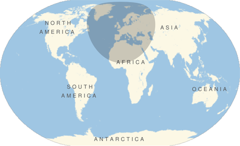
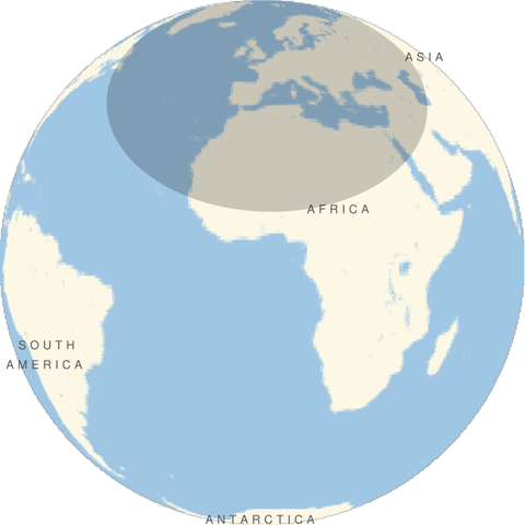
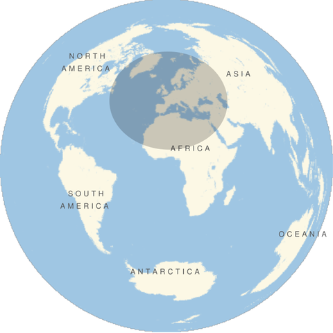
The other day I saw an image of a large disk centered on Paris subjected to the Mercator projection. I was playing around in Mathematica and made similar images for different projections. Each image below is a disk of radius 4200 km centered on Paris (latitude 49°, longitude 2°).
All images were produced with the following Mathematica code, changing the GeoProjection argument each time.
    GeoGraphics[GeoDisk[GeoPosition[{49, 2}],
       Quantity[4200, "Kilometers"] ],
       GeoProjection -> "...",
       GeoRange -> "World"]
Robinson projection
… GeoProjection -> "Robinson", …

Winkel-Snyder projection
… GeoProjection -> "WinkelSnyder", …
Orthographic projection
… GeoProjection -> "Orthographic", …
Lambert Azimuthal projection
… GeoProjection -> "LambertAzimuthal", …
Peirce Quincuncial projection
… GeoProjection -> "PeirceQuincuncial", …
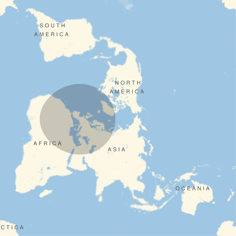
This last projection has some interesting mathematics and history behind it. See this post for the backstory.